Gravel Routes in Helper, Utah
« Back to Utah
Helper, Utah

44 mi
gravel
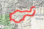
The Back 40Gravel route from S Main St to W 4500 N, Helper, Carbon County, Utah "Great 40+ mile loop around the Wildlife Management Area & The Gordon Creek Railroad Trestle. A fast 6-mile paved downhill (going clockwise) down Consumer's Canyon is welcome after all the climbing. " 1 |

20 mi
gravel
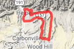
Fuzzy's Lunch LoopGravel route on S Main St, Helper, Carbon County, Utah "Fun, fast 20 mile loop. Up the Rail-Grade, across the Clay Banks, and around Wood Hill. Start & finish in Helper (of course)." 1 |

15 mi
dirt
Pondtown Rd to Starvation RdDirt route from Forest Rd 0009 to Starvation Rd, Spanish Fork, Utah County, Utah "a little rough and rocky. Lightly traveled." |
